
Humansdorp District Eastern Cape
KROMME-GEELHOUT CONSERVANCY MANAGEMENT PLAN
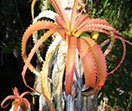
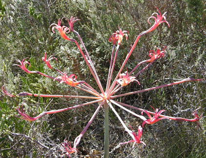
The endangered plant Brunsvigia litoralis which occurs in the Conservancy
January 2012 – January 2017
Vision
“Preservation of vegetation, wildlife and biodiversity in a unique area for present and future generations”
Motivation for establishment of conservancy in relation to the vision
Legislative motivation
The Conservancy is in line with legislative and spatial planning requirements, including the following (see also section 3.3):
- The Constitution
- The National Environmental Management Act (NEMA) – NEMA principles
- The Eastern Cape Biodiversity Conservation Plan
Unique vegetation types
The primary vegetation type in the conservancy is classified as “Humansdorp Shale Renosterveld” (Mucina & Rutherford, 2006) which is listed as endangered and inadequately conserved. The target for conservation is 29% while only 6% enjoys protection on private land. None is conserved in statutory conservation areas and the conservancy will contribute to the preservation of this unique vegetation type.
The conservancy also contains intertidal salt marshes (“Cape Estuarine Salt Marshes”) and “Gamtoos Thicket”. Both of these are “least threatened” but only 6% of the thicket is currently protected in conservation while the target is 19%.
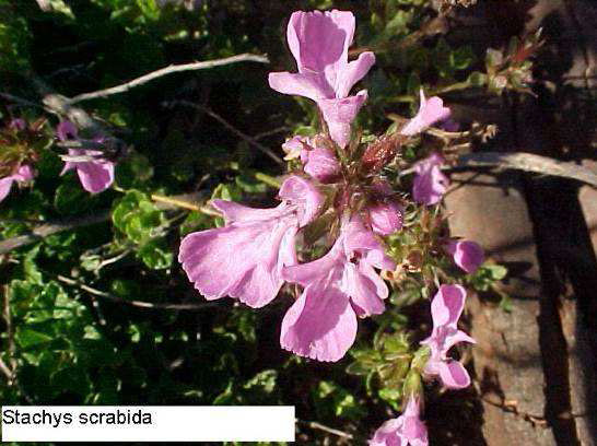
The area also falls within the Albany Centre of Endemism (van Wyk & Smith, 2001) and therefore contains several species restricted to the area such as Bobartia macrocarpa, Lauridia reticulata, Limonium linifolium, Metalasia aurea, Pavonia praemorsa, Stachys scabrida and Thesium scandens. Succulent endemics / near endemics include Delosperma ecklonis, Cotyledon velutina, Cotyledon woodii, Crassula lactea, Crassula mucosa, Crassula pellucida marginalis, Crassula tetragona acutifolia, Haworthia gracilis, Pelargonium pulverulentum, Senecio angulatus, and Roepera maritime. Van Wyk & Smith further note that there is a lack of species lists for the Albany Centre of Endemism and the species database currently being developed by the conservancy could contribute greatly in this regard.
Ensure sustainability
The general Kromme River area is facing increasing pressure from development including the marina at St Francis, expansion of farming areas within the catchment and sub-division and development of properties. The Kromme-Geelhout conservancy provides a contained area within which development will be in line with the principles of the conservancy, the relevant spatial planning frameworks and in keeping with the carrying capacity of the area.
Goals
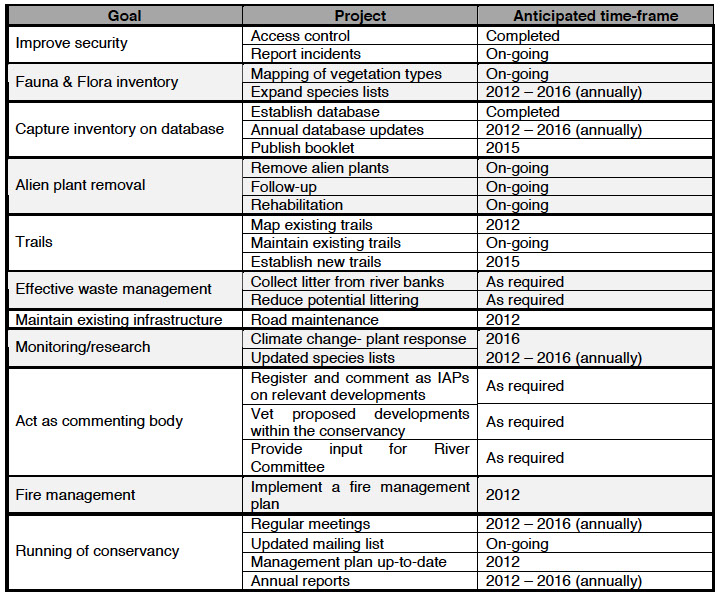
The goals of the conservancy are outlined below along with proposed associated projects that are envisaged to take place within the next 5 years. For a summary please refer to Table 1 below.
Improve security
The aim is to improve security in the area by controlling access to the conservancy. This includes overall physical security as well as protection of the ecosystem though the prevention of poaching, unauthorized vehicle access, disturbance to rare species and damage to the fynbos caused by quadbikes and irresponsible drivers. The overall goal is to ensure that future generations can enjoy the natural beauty of the area in safety and security.
In order to achieve this goal, the following projects are proposed:
Projects:
- Establish access control: A gate at the junction of the conservancy access road and the main Oyster Bay– Humansdorp road has been installed. Regular maintenance and monitoring is required.
- Reporting of incidents: Incidents involving the gate (e.g. damage to the gate) are reported to a local person who can affect the necessary repairs. Incidents of unauthorized access are reported to the relevant landowner by the person detecting the incident. Incidents may also be reported via the conservancy email list.
Establish an inventory of fauna and flora in the conservancy
In order to manage the conservancy effectively, a list of the species occurring in the conservancy is needed. In particular species requiring special protection and/or management need to be identified. The following projects are proposed to assist in achieving this goal:
Projects:
- Mapping of vegetation types: Although maps of vegetation types (e.g. Mucina & Rutherford and the ECBCP) do exist for the general area, they are at a coarse scale and do not reflect all of the vegetation types within the conservancy. The aim of this project is to map the vegetation at a finer scale. This will be undertaken as an on-going project over the next 5 years. The project will involve the identification of species and mapping thereof on a Google Earth image.
- Expansion of species lists: The lists of fauna and flora as given in Appendices 2-11 will be expanded and updated. Input from interested parties and/or experts from outside the conservancy will be welcomed and facilitated as far as possible. We envisage that the lists will be updated on an annual basis based on information submitted by the conservancy members over the course of each year.
Capture the inventory information in a database
To allow access to all members and other interested parties and to help with identification
Projects:
- Establish an electronic database: An Access database (pictures plus information) – has already been established and is updated on an annual basis (copy provided to DEDEAT)
- Keep database up-to-date: The database will be updated (new species information, species name changes etc) on an annual basis
- Publish booklet on conservancy: The conservancy is investigating the possibility of publishing a booklet on the conservancy but this is dependent on obtaining the necessary funding. Funding could possibly be obtained from WESSA.
Remove invasive alien plant species
To maintain the indigenous fauna and flora in as pristine a state as possible by the removal of alien species and by protecting the environment from further degradation.
Projects:
- Removal of alien vegetation: An attempt is already being made to control the alien vegetation within the conservancy and this effort will be intensified. Trees will initially be cut down as close to the ground as possible and coppice growth sprayed with GarlonTM, TimberelTM or other registered herbicides. This method has proved to be very successful. Alien seedlings will be hand- pulled whenever possible. The areas cleared will be reported on in each annual report.
- Follow-up of cleared areas: Regular follow-up programmes are undertaken to ensure that the areas cleared remain free of aliens. Follow-up consists of removing seedlings by hand or by spraying regrowth. The areas followed-up on will be reported on in each annual report.
- Rehabilitation: Areas that have been cleared of alien vegetation require no active rehabilitation apart from being kept clear of alien seedlings as they are rapidly re-colonised by plants from the surrounding areas. Where possible photos of areas which have been cleared and are now rehabilitating will be provided in the annual reports.
Create and maintain a network of trails
It is the intention of the conservancy to create and maintain a network of walking trails within the conservancy. The trails will be used primarily for recreational purposes, but will also be used to access areas to monitor for invasive alien plants. Some trails already exist but are disjointed and not known to all conservancy members.
Projects:
- Map existing trails: The existing trails will be mapped and the map made available to all conservancy members.
- Maintain existing ones: This is undertaken on an annual basis or as needed by the owners of the properties concerned.
- Establish new trails: A long-term project is to link existing paths and create new ones.
Ensure effective waste management
Currently all household waste is removed by the owners and disposed of at the Municipal landfill site in Humansdorp. The houses all operate on a septic tank system but these tanks are all more than 3m above the high water mark and the risk of pollution is thus considered negligible. Recycling is currently not practical due to the lack of facilities to take the recycled waste to.
Projects:
- Collect litter from river banks: Litter often accumulates on the banks of the river especially after the holiday season or if floods have washed debris down the river. Collection of litter is undertaken on an “as needed” basis by the respective landowners.
- Reduce potential littering: Efforts will be made to curtail littering by education of the property owners, their guests and local residents.
Undertake monitoring & research
It is planned to monitor the environment on a regular basis and all species lists and climatic data will be updated as new information becomes available. Research into all aspects of the environment by any interested parties will be actively encouraged.
Projects:
- Climate change: Climate change is a reality and it is hoped that the species lists can be used to monitor any significant changes in vegetation types. Due to the magnitude of this project it has been identified as a very long term goal.
- Updated species lists/expand knowledge: Van Wyk & Smith (2001) note that there is a lack of species lists for the Albany Centre of Endemism and the species lists currently being compiled by the conservancy could contribute greatly in this regard.
Maintain existing infrastructure
The key infrastructure in the conservancy consists of the main access road and Telkom and Eskom lines. Telkom and Eskom are responsible for the maintenance of their own infrastructure while responsibility for the road lies with the land users and not the local authority. The road is thus jointly maintained by the conservancy members and other property owners that use the road.
Projects:
- Road maintenance: The road requires periodic maintenance to ensure accessibility (for members as well as for emergency services) and to prevent erosion through uncontrolled run-off.
Provide comment on relevant developments
The conservancy acts as a watchdog body and comments on various developments in the area if appropriate. This is usually done by registering as an IAP (Interested and/or Affected Party) via the EIA process.
Projects:
- Register as IAPs for developments e.g. for the proposed Thyspunt nuclear power station
- Act as advisory body for proposed developments within the conservancy by conservancy members
- Provide input for the Kromme River Committee (which is an umbrella body representing stakeholders along the entire river and marina areas) via representation of a conservancy member on the River Committee.
Adhere to fire management requirements
The following provisions of the Veld & Forest Fires Act (101 of 1998) are of relevance:
Chapter 2 – fire protection associations
It is not the intention of the Conservancy to form a new fire protection association but to rather link in with existing ones where possible as this would be more effective in achieving the overall aims of the Act. As per section 3(1) of this chapter, the formation of a fire protection agency is voluntary (“owners may form an association…”) unless the Minister determines otherwise.
Section 12 – duty to prepare and manage firebreaks
As per Section 12(1), the Conservancy acknowledges the need to prepare and maintain a firebreak. As per the provisions of Section 12(7), a common firebreak will be established rather one on each individual property.
Chapter 5 – fire fighting
The conservancy will as part of their fire management plan take stock of available firefighting equipment and resources (such as the local fire department) and will map water sources available for use in firefighting.
Projects:
- Implement a fire management plan
- Submit a map of available water reservoirs to the Humansdorp Fire Department
- Approach neighbouring farms to ascertain if it is possible to use any fire fighting equipment or manpower which they may have available
Ensure smooth running of the conservancy
Certain administrative tasks are required to ensure that the conservancy functions optimally. This is especially important as most of the members are not based at the conservancy full time but utilize it throughout the year for holidays.
Projects:
- Regular meetings plus minutes thereof
- Ensure mailing list of conservancy members is up-to-date and members are alerted to relevant matters
- Ensure management plan is up to date and a new plan submitted every 5 years or as DEDEAT requires
- Submit an annual report to DEDEAT
Table 1. Summary of goals and projects
Background information on the conservancy
History of the area
The area of land covered by the conservancy was originally all owned by Dr FW Morrison. He was a keen naturalist and lover of ‘wild places’ and was always concerned about the possibility of commercialisation and over-development. It was Dr Morrison who had the foresight to include the no camping, leasing or further subdivision clauses in the title deeds of all the properties he sold.
Reason for establishment
In recent years the serenity, natural beauty and biodiversity of the area have been threatened by the invasion of many alien plant species as well as by an upsurge of crime in the area. These problems have become too big for any single property owner to cope with alone and it has become obvious that united action is required. A meeting of all interested landowners was therefore held in January 2004 at which a decision was taken to apply for conservancy status. A further meeting was held in January 2005 at which a committee was elected. The landowners and a representative of DEDAET attended this meeting. A formal certificate of recognition was issued by DEDEAT on 14 June 2009.
Applicable legislation, policy and guidelines
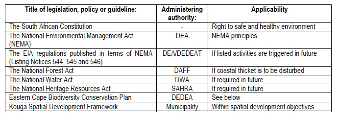
Eastern Cape Biodiversity Conservation Plan
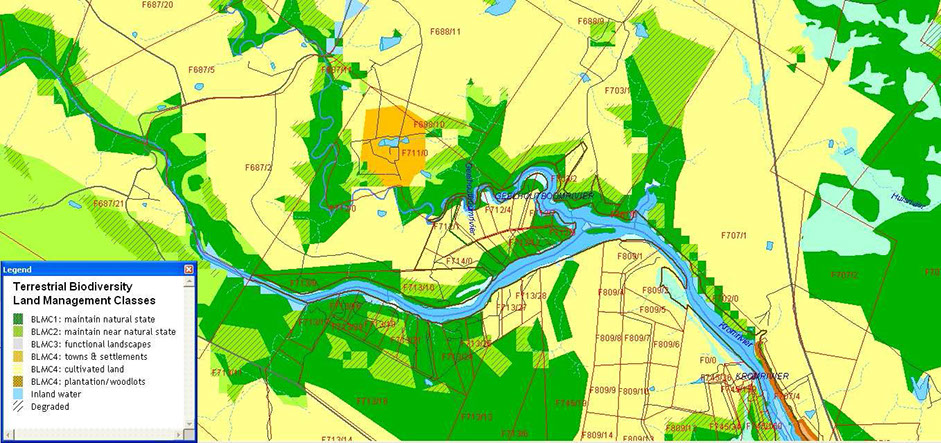
According to the ECBCP, the conservancy falls partly within critical biodiversity areas (dark green on the figure below) which should be maintained in their natural state. The remainder of the conservancy is identified as “cultivated land” although this is not the case.
Many of these “cultivated areas” are covered with Humansdorp Shale Renosterveld which according to Mucina and Rutherford (2006) is endangered. It is likely that the scale of the ECBCP is not fine enough to identify these renosterveld areas.
Figure 1: ECBCP map
Conservancy details and landowners
Name of Conservancy
The name of the conservancy is the Kromme-Geelhout Conservancy
Total Area:
The total area of the conservancy is 148.1ha.
Locality and boundary description:
The conservancy lies on a peninsula between the Kromme and Geelhoutboom Rivers in the district of Humansdorp. It extends from
approximately 24º46’50”E in the east to 24º45’25”E in the west and from 34º07’25”S in the south to 34º06’40”S in the north. The
general geographical location is shown in Figure 2.
Figure 2: The geographical location of the conservancy
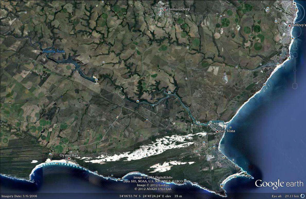
Figure 3: The plots within the Kromme-Geelhout Conservancy
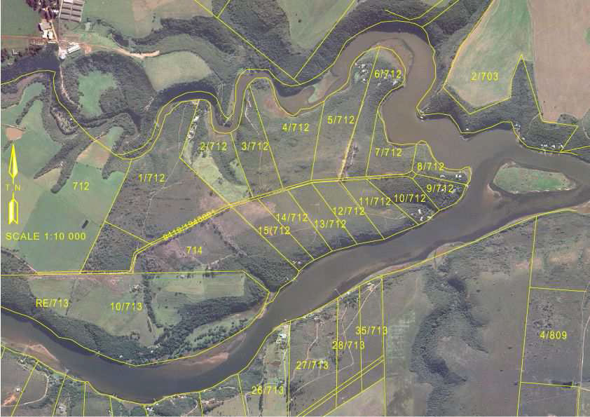
The conservancy includes most of the land on the peninsula between the Kromme and the Geelhoutboom rivers as shown in Figure 3. At present the conservancy excludes a single property (Portion 1), which is involved in commercial activities. It is hoped that this property will be added to the conservancy at a later date.
Responsible regulatory authorities
Responsible regulatory authorities include:
- The Cacadu District Municipality
- The Kouga Local Municipality
- DEDEAT: Western Region, Jeffrey's Bay Office
- DEDEAT contact person and details: Gerrie Ferreira
- DEDEAT
PO Box 1733
Jeffrey's Bay 6330
Tel: 042-2920339
Table 2 Property owners and contact details

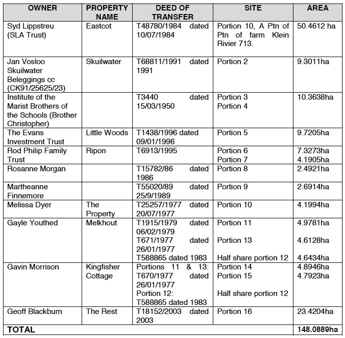
Property ownership details
Note:
The farm Eastcot is the remainder of Portion 10 (a Portion of Portion1) of the farm Klein River No 713 in the division of Humansdorp and is a private nature reserve declared in terms of Section 12(4) of the Nature and Environmental Conservation Ordinance. It is known as Eastcot Private Nature Reserve gazetted 20/201987.PN65/1987.
Portions 2-13 are all Portions of Portion 1 of the farm 712, District of Humansdorp
Table 3 Property ownership details
Servitudes
Property owners are responsible for a pro-rata share of the upkeep of servitude rights of way over adjoining properties. There are also servitudes allowing private access and the storage and diversion of water from the Kromme River over adjacent properties. Currently none of these rights are being exercised and any such proposed activities would be subject to the approval of the Department of Water Affairs (fresh water) or Marine & Coastal Management (salt water). The title deeds of each property include restrictions on sub-division, leasing and camping.
Eskom and Telkom also have servitudes/right of way across the properties.
Conservancy functioning/management
Constitution
The constitution of the conservancy is attached as Appendix 1.
Communication
- Meetings / forums: Meetings of the conservancy members will be held as laid down in the Constitution (Appendix 1). Such meetings include the annual general meeting of members of the conservancy which shall be held annually at a place and time determined by the executive committee. Written notice of such annual general meeting shall be given to each member at least 14 days prior to the intended meeting. The executive committee may at any time also convene a special general meeting, provided that notice is given in the same manner as for an annual general meeting and the matters to be discussed are clearly stated in such notice. A special general meeting must be convened if one-third or more of the members request such a special meeting.
- Email communication: The conservancy maintains an updated list of members’ email addresses and the chairperson or the secretary distributes information when necessary. This email list is also used by any member wishing to raise any issues.
- Liaison with other organizations: The conservancy has representation on the River Committee as well as links to WESSA
Annual report
A copy of the annual report will be submitted to DEDEAT every year.
IAP complaints
All complaints received will be forwarded to the chairperson who will record them as well as the response/action taken. Efforts will be made to resolve complaints to the satisfaction of all parties concerned.
Administrative matters
Asset management:
All members of the conservancy will be responsible for a pro-rata share of the upkeep the communal access road, road signs and the access control system.
- Personnel management: No staff are employed on a full time basis. Local residents may be employed on a part-time basis from time to time to help with such projects as the eradication of alien trees or road repair.
- Financial management: The financial affairs of the conservancy will be handled by the Treasurer as laid down in the Constitution (Appendix 1)
- Constitution: Amendments to the constitution may be made as given in Section 10 of the Constitution (Appendix 1).
- Sub-committee activities: Sub-committees may be appointed from time to time to undertake specific tasks such as the installation of the access control system, road maintenance or the removal of specific areas of alien vegetation.
- Training: Since the conservancy does not employ any permanent staff no formal training will be undertaken. Contract staff will be trained to do the specific task required of them if necessary.
- Security management: Land access to the conservancy is controlled by means of a security gate, which has been placed on the main access road near its junction with the road to Humansdorp. No control over river access is possible while the owners are away. Members keeping an eye on each other’s houses when the owners are not present will improve security.
- Development control: Any changes in such things as roads or land use, which affect the conservancy as a whole, will be approved by a majority of the conservancy members before being undertaken.
- Standards: The speed limit along the access road will be 40 kph and this will be indicated on signs along the road. The cost of maintenance of any road signs will be on a pro-rata basis.
- Use of poison: The only poisons used within the conservancy are the herbicides used to control alien invasive plants and some cattle dip, which is used on the farm Eastcot. At present very limited quantities of these chemicals are used. The herbicides (less than 1 litre at a time) are brought in by the owners when they come on holiday. All diluted herbicide is used up and there is no waste to dispose of. Any surplus concentrate is stored in a locked room while the owners are away. No more than 500ml of cattle dip is used on Eastcot at any given time. The use and storage of these chemicals poses no environmental threat.
Physical description
Overall description
The conservancy covers 148 hectares of land on the peninsula formed between the confluence of the Geelhoutboom and Kromme Rivers. This land is split into 14 portions ranging in size from 2-50 hectares. Improvements on each property typically include a house, dirt access road, Eskom line and borehole. Apart from this infrastructure, the properties are in their natural state.
From the rivers the land generally slopes fairly steeply to where the vegetation transitions from Gamtoos Thicket to Humansdorp Shale Renosterverld. At this transition point the land flattens out and the top of the peninsula is flat with only a few very minor undulations which are typically along small drainage lines. Where salt marshes occur they do so on the river banks in the transition zone between the river and the riverine thicket.
Geology
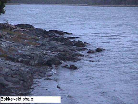
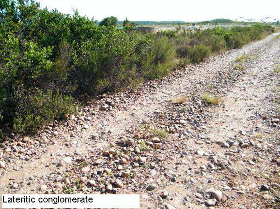
The conservancy is part of a coastal terrace into which the Geelhoutboom and Kromme Rivers have incised themselves. The underlying rocks are slates and shales belonging to the Bokkeveld group with hydrothermal quartz intrusives in places. These shales are overlain unconformably by a lateritic conglomerate (marine pebbles), which forms the terrace surface.
Figure 4: Rock types
Mineralisation: The rocks of the Bokkeveld group are notoriously poorly mineralized. The hydrothermal quartz intrusives, however, do carry traces of gold and an unsuccessful attempt was made in the early 1900s to mine one of these quartz veins occurring on the Eastcot property (see Section 8). Some clay and ochre occurs at the base of the lateritic conglomerate but these are of no economic significance.
Water resources
The conservancy is surrounded on three sides by estuarine rivers and there are no surface fresh water resources. Groundwater in the area is not abundant and has a fairly high salt content, but is generally suitable for domestic use.
Climate:
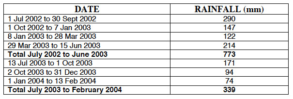
The climate is temperate with generally non-seasonal rain with slight optima in March and November. The average annual rainfall is approximately 600-800mm p.a. Further rainfall information will be recorded as it becomes available.
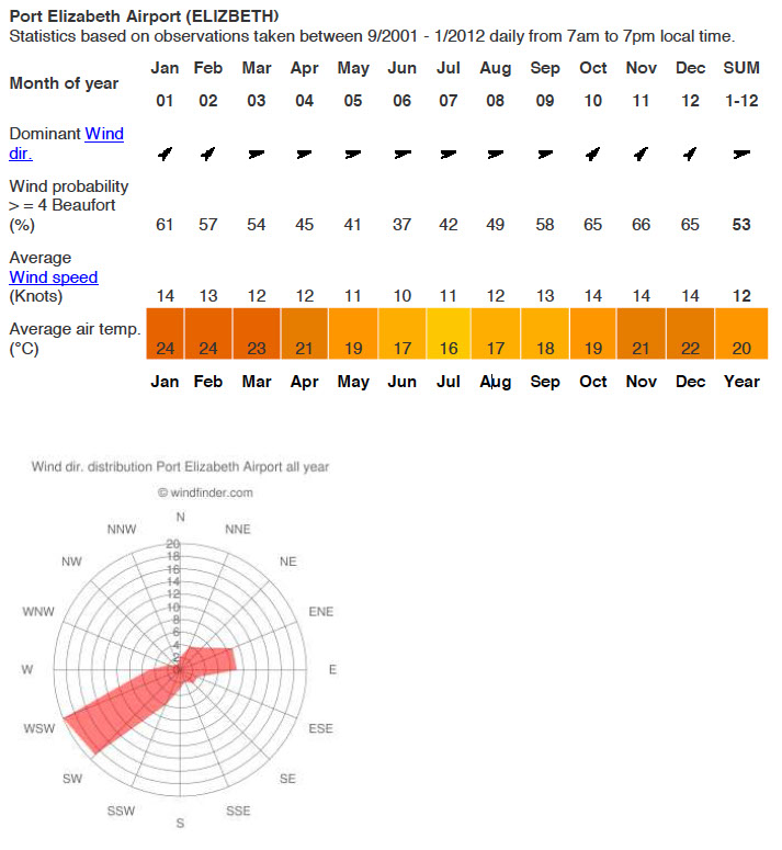
The average maximum daily temperature for the region is 24° in January and the average minimum daily temperature is 9° in July. The closest official weather station is at Port Elizabeth Airport and the following statistics are available.
A limited range of rainfall statistics is available for the Kromme-Geelhout Conservancy due mainly to the fact that available rain gauges can only be emptied when members are in residence over the holiday season. An effort will be made to gather more climate information.
Table 4: Rainfall figures for the conservancy
Land uses:
The predominant land-uses are open space and recreation. Recreational activities (swimming, boating) are generally concentrated on the river and river banks, while some (such as walking, running and cycling) occur throughout the conservancy area. The rest of the land is used as open space. There is also some very limited farming on the Eastcot property where approximately a dozen cattle are kept on 40-45 hectares.
Vegetation description:
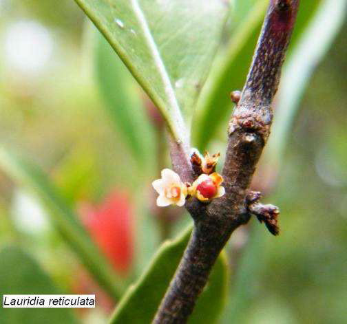
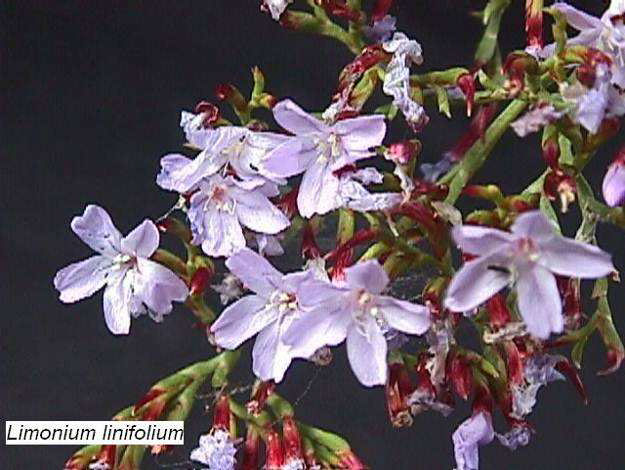
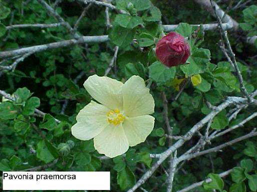
The area covered by the conservancy falls within the limits of the Albany Centre of Endemism (Van Wyk and Smith, 2001). A number of plants are found which are endemics / near endemics to the Albany Centre. Non-succulent species include Bobartia macrocarpa, Lauridia reticulata, Limonium linifolium, Metalasia aurea, Pavonia praemorsa, Stachys scabrida and Thesium scandens. Succulent endemics / near endemics include Senecio angulatus, Cotyledon velutina, Cotyledon woodii, Crassula lactea, Crassula mucosa, Crassula pellucida marginalis, Crassula tetragona acutifolia, Pelargonium pulverulentum, Haworthia gracilis, Delosperma ecklonis and Roepera maritima.
Figure 5: Some endemic plants
Vegetation types
The conservancy contains a number of different vegetation types which include:
- Fynbos
- Gamtoos (Riverine) Thicket
- Tidal wetlands
- Seasonal wetland
- Agricultural land
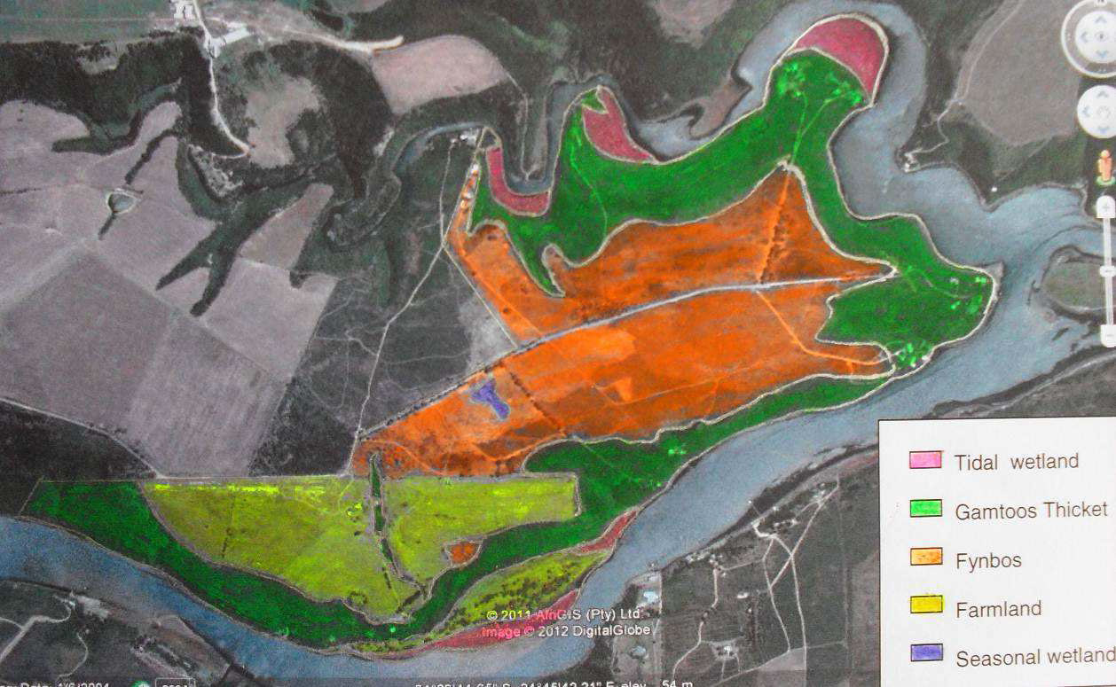
Each of these vegetation types is described in more detail below and the areas covered by each are shown in Figure 6.
Figure 6: The vegetation types
Fynbos
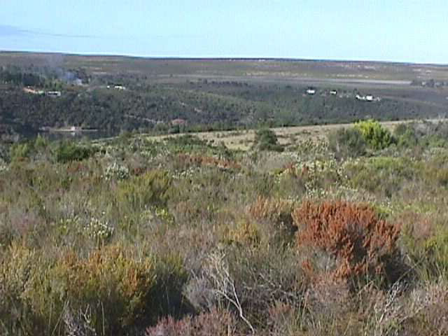
The conservancy falls within the Fynbos Biome and is classified as Humansdorp Shale Renosterveld (Mucina & Rutherford (eds.) 2006) This veld type was formerly known as Coastal Renosterveld or South Coast Renosterveld (Low & Rebelo, 1996). Within the conservancy the fynbos element is found mainly on the raised plateau between the Kromme and Geelhoutboom Rivers. This fynbos has a high proportion of grasses such as redgrass (Themeda triandra), ratstail dropseed (Sporolobus africanus), velvet signal grass (Brachiaria serrata) and Pentaschistis pallida. Other typical and dominant plants include Hermannia flammea, Chaetacanthus setiger and Indigofera denudata. A complete list of the indigenous plant species is given in Appendix 2.
Figure 7: Some typical fynbos plants
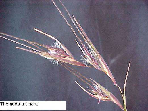

Figure 8: Humansdorp Shale Renosterveld
- Gamtoos Thicket
The steeply sloping banks of the rivers are covered with Gamtoos Thicket (Mucina & Rutherford (eds.) 2006).
Figure 9: Gamtoos thicket
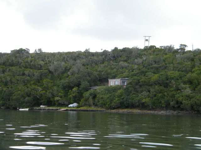
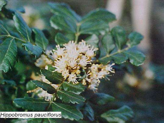
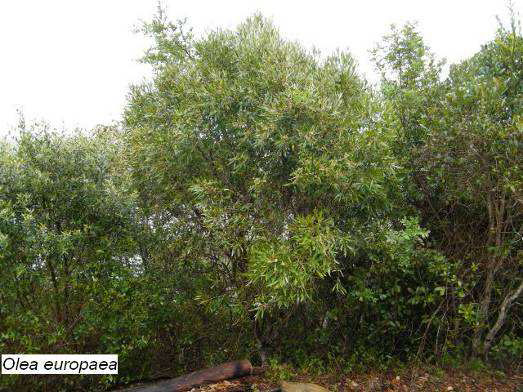
This thicket was formerly classified as Kromme Forest Thicket. The generally north-facing slopes on the Geelhoutboom River side of the conservancy are hotter and drier than those on the south-facing Kromme River side. The vegetation on the north-facing slopes is shorter and more stunted than that on the south-facing slopes. Although many species are common to both slopes there are some differences in community structure. Some of the dominant species in the thicket are Hippobromus pauciflorus, Euclea undulata var. undulata, Mystroxylon aethiopica and Olea europaea africana.
Figure 10: Common thicket species
There are a number of very old Podocarpus falcatus trees on the farm Eastcot. These trees are some of the few in the area which escaped the devastating fire which swept the region in the late 1800s.
- Tidal wetlands
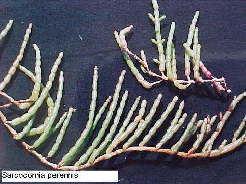
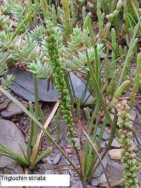
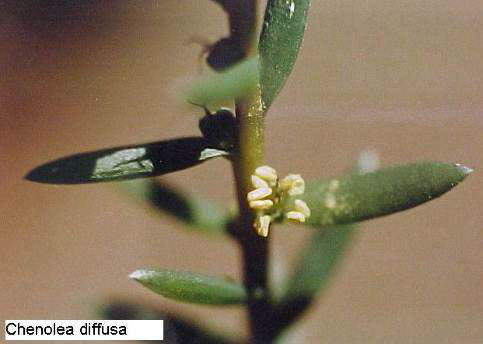
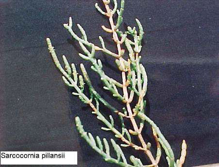
There are a number of tidal wetlands along the banks of both the Kromme and the Geelhoutboom rivers. These wetland areas are only flooded at very high spring tides. Common plants include Sarcocornia perennis, Sarcocornia pillansii, Salicornia meyeriana, Chenolea diffusa and Triglochin striata.
Figure 11: Tidal wetland plants
- Seasonal freshwater wetlands
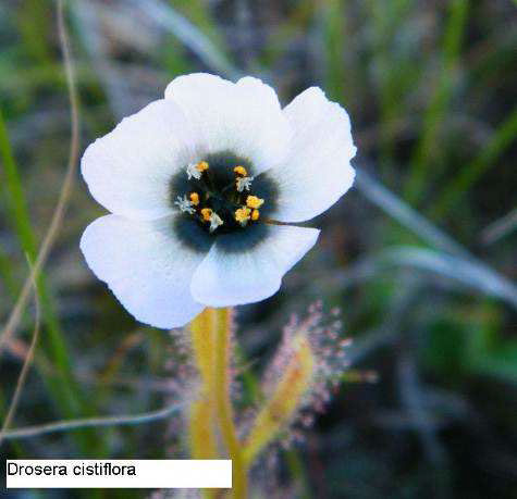
There is only one small freshwater wetland in the conservancy which has largely dried up due to alien Eucalyptus trees. Remnants of wetland vegetation include Drosera cistiflora, Grammatotheca bergiana and Wurmbea stricta.
Figure 12: Freshwater wetland plants

- IUCN listed plants (International Union for Conservation of Nature)
The only plant that is listed as being Endangered (Victor and Dold, 2003; Red List of South African Plants) is Brunsvigia litoralis, while Bobartia macrocarpa and Pauridia minuta have been listed as Near Threatened. Plants which were previously listed in the Red Data list as ‘threatened with extinction’ but which are now listed as Least Concern (LC) or Rare (R) (Victor and Dold, 2003) include Agathosma ovata (LC), Bonatea speciosa var. speciosa (LC), Carpobrotus delisiosus (LC), Cotyledon velutina (LC), Gladiolus maculatus (LC), Pentaschistis pallida (LC), Podalyria burchellii (LC), Selaginella pygmaea (R) and Chaenostoma campanulatum (LC).
Figure 13: Some IUCN listed plants
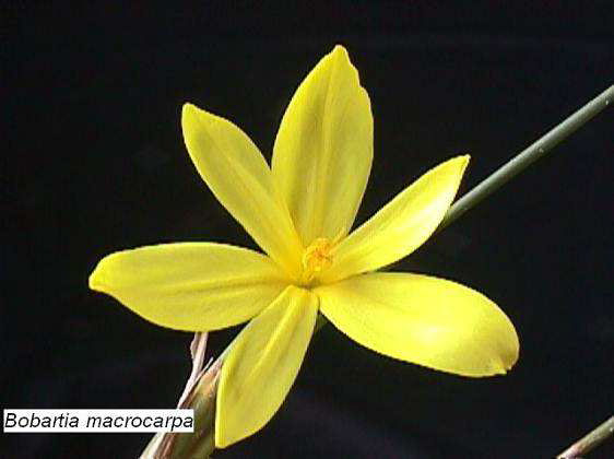
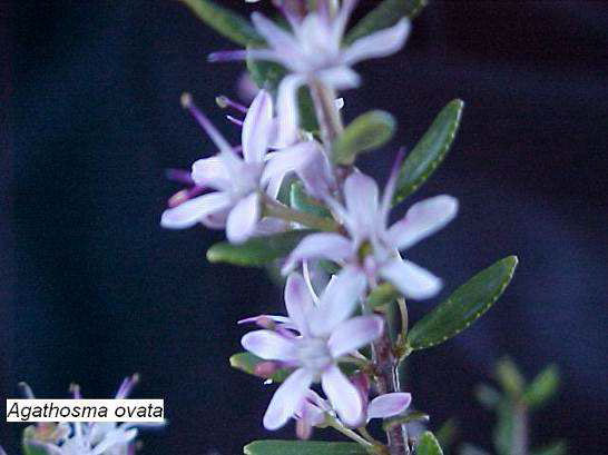

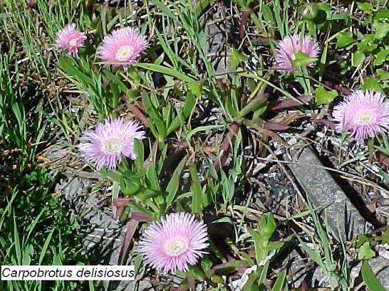
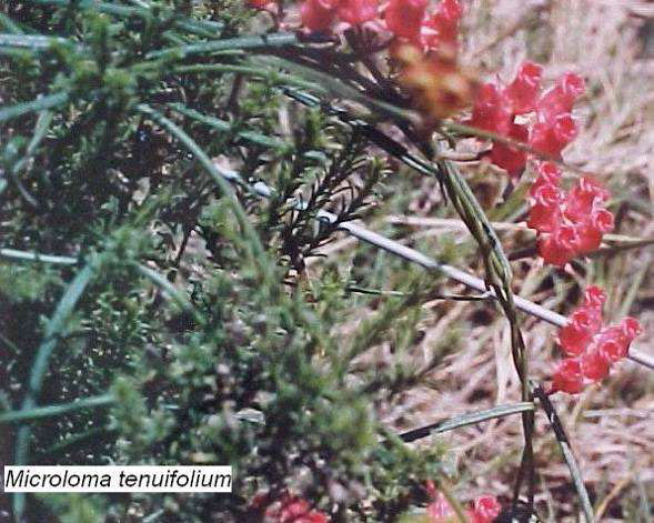
Freesia corymbosa, which was previously listed in the Red Data list as “threatened with extinction” but which is now listed as Least Concern or Rare (Victor and Dold, 2003), has been found on the southern bank of the upper reaches of the Kromme River in the gorge region. Although this plant has so far not been found on Conservancy land it is possible that it could occur there. The plant Microloma tenuifolium used to occur on the conservancy land but no specimens of this plant have been seen for about 15 years.
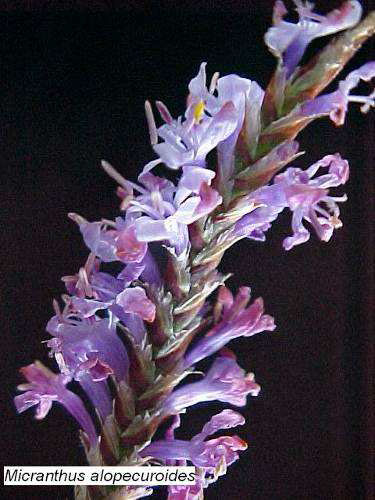
A number of plants which occur in the conservancy are outside their listed distribution range. These include Hesperantha acuta, Gladiolus tristis, Micranthus alopercuroides, Orphioglossum bergianum, Pauridia minuta, Spiloxene aquatica and Wurmbea stricta.
In addition to the indigenous vegetation a large number of alien plant species are found, including many invader and weed species.
- Plant usage
A number of the plants which occur in the conservancy have been recorded as having traditional medicinal uses. No medicinal usage has been reported within the conservancy itself. Invader species such as black wattle (Acacia mearnsii) and rooikrans (Acacia Cyclops) are generally used as firewood. Much of this wood is purchased from local people who make a small income from its sale.
- Faunal description:
A list of the birds is given is Appendix 4, mammals in Appendix 5, amphibians and reptiles in Appendix 6, land molluscs and other invertebrates in Appendix 7, insects in Appendix 8 and spiders in Appendix 9. These lists of fauna and flora will be expanded and updated on an ongoing basis and the information recorded in a database. Research by interested parties from outside the conservancy will be welcomed and facilitated as far as possible.
As the high tide level forms the boundary of the conservancy no riverine species fall within the conservancy boundaries. They are, however, included in the database and species lists as this information could be used to track water quality changes.
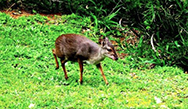
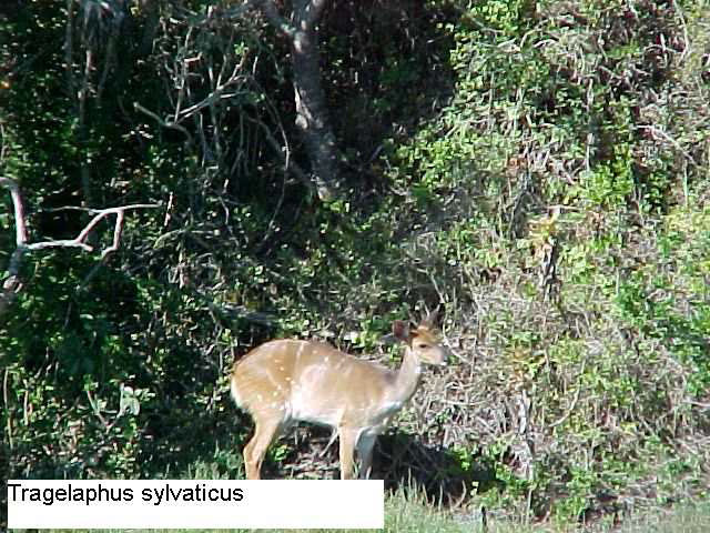
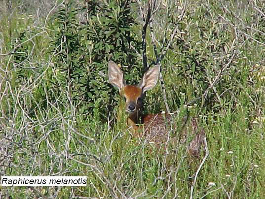
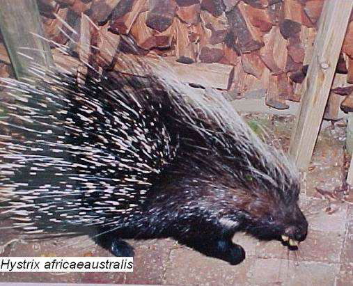
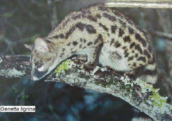
Common large mammal species in the conservancy include the bushbuck (Tragelaphus sylvaticus), the grysbok (Raphicerus melanotis), the porcupine (Hystrix africaeaustis) and the gennet (Genetta tigrina).
Figure 14: Common mammal species
- IUCN listed animals
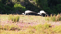
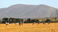
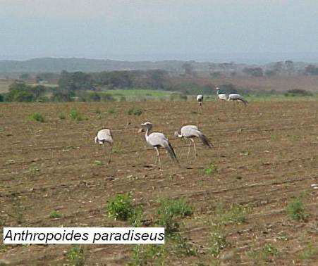
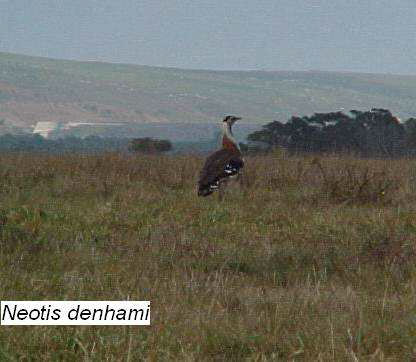
The blue crane (Anthropoides paradiseus) is listed as an Endangered Species. Denham’s bustard (Neotis denhami) is listed as Near Threatened and the baboon spider (Harpactira chrysogaster) is a Protected species. The Cape clawless otter (Aonyx capensis), which is also a protected species, is thought to occur in the area since crab remains are often found. This animal has not yet been positively identified due to its secretive nature.
Figure 15: Some IUCN listed animals
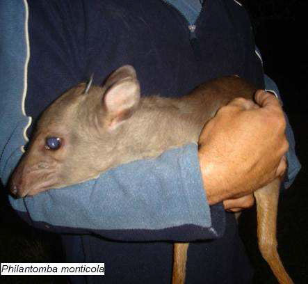
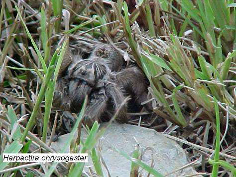
Cape hyrax (Procavia capensis) used to be common on rocky slopes along both the Kromme and Geelhoutboom Rivers but none have been seen on conservancy land since about 2003 and it appears that they no longer occur in this area. There has only been one sighting of an aardvark in recent years but a number of termite mounds show signs of having been dug open. The hamerkop (Scopus umbretta) also used to be more common in the area than it is currently.
- Management of the fauna
No formal census of the mammal fauna will be undertaken due to the difficulty of conducting a census in the dense vegetation. While every effort will be made to prevent poaching, no formal management measures are envisaged at this stage. The conservancy members will, however, be informed about the IUCN listed species. In addition to the indigenous fauna there are a few alien animal species. These exotic species occur in very low numbers and no formal management is required.
The conservancy database
The conservancy database is an access database which contains information on the following:
- Indigenous plants, lichens fungi, hepatophytes, bryophytes, gymnosperms and angiosperms
- Indigenous land invertebrates, insects, spiders, amphibians, reptiles, birds and mammals
- Exotic and invader plants and animals
- Riverine algae, invertebrates, molluscs, crustaceans, macrophytes, and fish. Although not strictly within the conservancy boundary these have been included as an aid to the identification of organisms seen by the members and also to allow for the possible tracking of water quality changes
- An historical collection of sea shells from the Kromme River mouth
Each record in the database contains the following information where it is available:
- The full taxonomy
- A brief description
- The conservation status or frequency of occurrence
- Synonyms
- Common names
- A colour photograph
- The time of year at which plants flower or migratory species are present
- The habitat
- Any known medicinal uses or poisonous properties
The database is fully searchable and may be searched by taxonomic names, common names, flower colour or habitat.
The database is updated on an on-going basis and is issued on a DVD free of charge to all members or other interested parties.
Fire management
Significant events/history
The conservancy land has been burnt on several occasions in recent years. These fires are generally confined to the fynbos vegetation and only rarely penetrate the Riverine Thicket. Recent fires have included the following:
The fynbos area burnt in August 1989 but no details are available about the cause or extent.
A major fire occurred in April 1991. This fire started on the Woodlands side of the Geelhoutboom River probably by picnickers who left a fire burning. This fire, driven by a strong berg wind, jumped the Geelhoutboom River and spread across the peninsula threatening the houses of Dr Morrison and Mr Blackburn. Considerable damage was done to the riverine bush on the Kromme River side of the peninsula and this has allowed alien tree species to invade the area.
In early June 2002 a relatively small fire started on the Vosloo property. This fire was confined mainly to the Vosloo, Marist Brothers, Evans, Morrison and Youthed properties. The cause of the fire was not determined.
Legislative requirements
The following provisions of the Veld & Forest Fires Act (101 of 1998) are of relevance:
Chapter 2 – fire protection associations
It is not the intention of the Conservancy to form a new fire protection association but to rather link in with existing ones where possible as this would be more effective in achieving the overall aims of the Act. As per section 3(1) of this chapter, the formation of a fire protection agency is voluntary (“owners may form an association…”) unless the Minister determines otherwise.
Section 12 – duty to prepare and manage firebreaks
As per Section 12(1), the Conservancy acknowledges the need to prepare and maintain a firebreak. As per the provisions of Section 12(7), a common firebreak will be established rather one on each individual property.
Chapter 5 – fire fighting
The conservancy will as part of their fire management plan take stock of available firefighting equipment and resources (such as the local fire department) and will map water sources available for use in firefighting.
Fire management plan
The conservancy covers a very small area of land and fire management will be undertaken by the conservancy as a whole and not by individual landowners. The conservancy is situated on a peninsula between the Kromme and the Geelhoutboom rivers and hence no special protection measures need to be put in place along these boundaries. Fire management is, however, required on our eastern boundary where conservancy land adjoins neighbouring farmland. In terms of the Veld and Fire Act 101 of 1998 we are obliged to create and maintain firebreaks along this border. The firebreaks which already exist do not penetrate the riverine bush and none will be cut into the bush as it does not burn. Cutting into the riverine bush merely allows the fire access and also allows entry to alien species which pose a very much greater fire hazard.
- Firebreaks
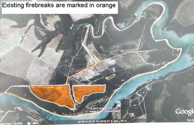
The existing firebreaks are shown in the map below (Figure 16). A wide mowed field separates the farm Eastcot from the neighbouring properties and this forms a very effective firebreak on that side. The firebreak then follows the access road which runs the length of the peninsula. The remaining border between the Vosloo property and the neighbouring Malherbe property also has a road which runs very close to or on the boundary line and which acts as a firebreak. These firebreaks are all permanent features and require no special maintenance.
Figure 16: Existing firebreaks
- Fire response plan
In the event of a fire it will be reported to the Humansdorp Fire Department by whoever fist discovers it. A map will be drawn of the location of water reservoirs which may be used in case of fires. This map will be supplied to the Humansdorp Fire Department. There are currently 8 reservoirs available for them to use.
- Fire prevention
In addition, the neighbouring farm Woodlands is to be approached to ascertain if they have any fire fighting equipment or manpower which could be called on in case of a fire. The conservancy does not plan to maintain its own water truck since the property owners
are generally only there during holiday season and are thus not available to use it
Every effort will be made to prevent the start of fires by the education of landowners their families and staff.
No controlled burning of the fynbos will be undertaken due to the danger to homes, reservoirs and other property.
Special or threatened habitats
Fynbos area
The fynbos area of the conservancy falls within the endangered Humansdorp Shale Renosterveld (Mucina & Rutherford, 2006) of which only 6% is formally conserved. It is therefore very important that as much as possible should be under conservation control. The bulbous plant Brunsvigia litoralis is found in the fynbos area. This plant has been listed as Endangered (Red List of South African Plants) while Bobartia macrocarpa has been listed as Vulnerable and Pauridia minuta and Pterygodium newdigitata are listed as Near Threatened. Plants which were previously listed in the Red Data list as ‘threatened with extinction’ but which are now listed as Least Concern (LC) or Rare (R) (Victor and Dold, 2003) include Agathosma ovata (LC), Bonatea speciosa var. speciosa (LC), Carpobrotus delisiosus (LC), Cotyledon velutina (LC), Gladiolus maculates (LC), Pentaschistis pallida (LC), Podalyria burchellii (LC), Selaginella pygmaea (R) and Sutera campanulata (LC).
Wetlands
- Salt marshes
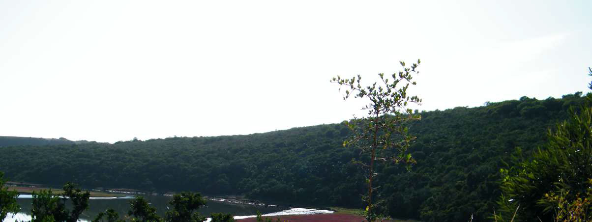
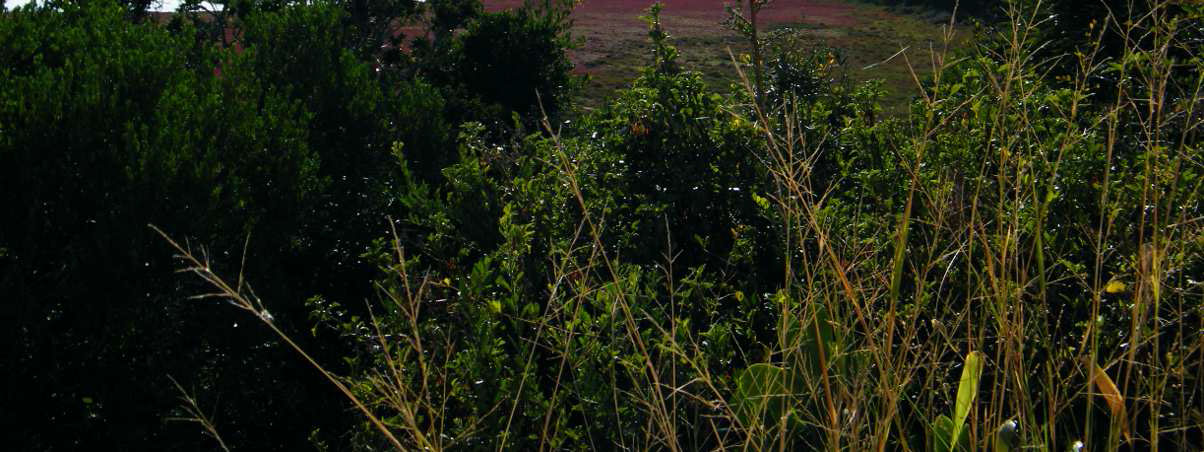
Tidal salt marches occur at numerous sites along the rivers and their position is indicated in the map Figure 6 which shows the
position of the various vegetation types.
Figure 17: Salt marsh
- Seasonal wetlands
The small area of wetland on Portion 16 (shown in Figure 6) is in danger of drying up due to the invasion of alien trees. Historically this area was far wetter than it is today.
Threatened species management:
A number of threatened plants and animals occur in the conservancy (see the sections on vegetation and fauna above) and the following management measures are being put into place:
- The conservancy members will be informed about the locality and conservation status of the plants Brunsvigia litoralis, Bobartia macrocarpa and Selaginella pygmaea to ensure that they are not accidentally disturbed. They will also be informed of the presence of the endangered animals Anthropoides paradiseus, Neotis denhami and Harpactira chrysogaster and requested to avoid disturbing them. In addition they will be asked to ensure that their domestic dogs do not disturb any wildlife.
- Alien vegetation is being removed to ensure that the habitat of these species remains in as pristine a state as possible.
- There are a number of rare and endanged species which have been recorded outside the conservancy borders and it is possible that they could also occur within our boundaries. They include Phyllodactylus peringueyi (Péringuey’s leaf-toed gecko), a rare gecko, which has been found inhabiting salt-marshes along the lower reaches of the Kromme River (The Argus 29/01/1992). Although this reptile has not yet been found on Conservancy land it is possible that it could occur there. A thorough search for this reptile in the salt-marshes along the banks of the Kromme and the Geelhoutboom Rivers should be undertaken by members of the Conservancy. Smith’s dwarf chameleon (Brachypdion taeniabronchum), which is listed as endangered in the Red Data book, has been found near the Churchill Dam and the Albany adder (Bitis armata), which is listed as very rare, and which was only described in 1997 in the Algoa Bay area could both possibly occur in the conservancy.
References
Scientific references
Alexander G, Marais J. 2007. A Guide to the Reptiles of Southern Africa. Struik Publishers, Cape Town, South Africa.
Baden C, Balkwill FM, Getliffe Norris FM, Immelman KL, Manning JC, Munday J. 1995. Flora of southern Africa Volume 30, Part 3: Acanthaceae.
Barnes KN. (ed.) 2000. The Eskom Red Data Book of Birds of South Africa, Lesotho and Swaziland.
BirdLife South Africa, Randburg, South Africa.
Branch B. 1988. Field Guide to the Snakes and Other Reptiles of Southern Africa. Struik, Cape Town, South Africa.
Branch GM, Griffiths CL, Branch ML, Beckley LE. 1994. Two Oceans. A Guide to the Marine Life of Southern Africa. David Philip Publishers (Pty) Ltd, Claremont, Cape Town.
Bromilow C. 2001. Problem Plants of South Africa. Briza Publications, Pretoria, South Africa.
Burrows JE. 1990. Southern African Ferns and Fern Allies. Frandsen Publishers, Sandton, South Africa.
Carruthers V. (ed.) 2008. The Wildlife of Southern Africa. Struik Publishers, Cape Town, South Africa. Codd LE. 1985. Flora of southern Africa, Volume 28, Part 4: Lamiaceae.
Codd LE. 1963. Apocynaceae. Flora of southern Africa. Volume 26: 244-296.
Dahlgren R.1988. Flora of southern Africa, Volume 16: Fabaceae, Part 3: Papilionoideae, Fascicle 6: Crotalarieae (Aspalathus).
De Vos MP. 1983. Flora of southern Africa, Volume 7: Iridaceae, Part 2: Ixioideae, Fascicile 2: Syringodea, Romulea.
De Vos MP, Goldblatt P. 1999. Flora of southern Africa, Volume 7: Iridaceae, Part 2: Ixoideae, Fascicle 1 Ixieae (First part).
De Winter B. 1963. Ebenaceae. Flora of southern Africa, Volume 26: 54-99.
Dickson CGC, Kroon DM. (eds). 1978. Pennington’s Butterflies of Southern Africa. AD Donker, Johannesburg, South Africa.
Du Toit PCV, Obermeyer AA. 1976. Ochnaceae. Flora of southern Africa, Volume 22: 1-13. Dyer RA. 1963. Myrsinaceae. Flora of southern Africa, Volume 26: 1-9.
Dyer RA. 1963. Plumbaginaceae. Flora of southern Africa, Volume 26: 15-31. Dyer RA. 1963. Primulaceae. Flora of southern Africa, Volume 26: 9-15.
Dyer RA. 1980. Ceropegia. Flora of southern Africa, Volume 27, Part 4: 43-82.
Filmer MR. 1993. Southern African Spiders. An Identification Guide. Struik, Cape Town, South Africa. ‘Gecko man’ Gordon finds ‘extinct’ lizard. The Argus 29/01/1992.
Germishuizen G, Meyer NL. (eds.) 2003. Plants of southern Africa: an annotated checklist. Strelitzia
14. National Botanical Institute, Pretoria, South Africa.
Gibbs Russell GE, Watson L, Koekemoer M, Smook L, Barker NP, Anderson HM, Dallwitz MJ. 1991. Grasses of Southern Africa. Memoirs of the Botanical Survey of South Africa No 58. National Botanic Gardens and Botanical Research Institute, Pretoria, South Africa.
Goldblatt P, Manning J. 1998. Gladiolus in Southern Africa. Fernwood Press, Vlaeberg, South Africa. Goldblatt P, Manning J. 2000. Cape Plants. A Conspectus of the Cape Flora of South Africa. Strelitzia
9. National Botanical Institute, Pretoria, South Africa and MGB Press, Missouri Botanical Garden, St Louis, Missouri, USA.
Goldblatt P. 1986. The Moraeas of Southern Africa. Annals of Kirstenbosch Botanic Gardens. Volume 14.
Heemstra P, Heemstra E. 2004. Coastal Fishes of Southern Africa. South African Institute for Aquatic Biodiversity and National Inquiry Service Centre, Grahamstown.
Henderson L. 2001. Alien Weeds and Invasive Plants. Plant Protection Research Institute Handbook No. 12. Plant Protection Research Institute, Agricultural Research Council.
Herbert D, Kilburn D. 2004. Field guide to the land snails and slugs of eastern South Africa. Natal Museum, Durban, South Africa.
Hilliard OM. 1999. The Tribe Selagineae (Scropulariaceae).Royal Botanic Garden Edinburgh, Scotland, United Kingdom.
Hilliard OM. Flora of southern Africa Volume 33 Asteraceae, Part 7: Inuleae, Fascicle 2: Gnaphaliinae. Hockey PAR, Dean WRJ, Ryan PG. (eds.) 2005. Roberts Birds of Southern Africa. 7th edition. John
Voelcker Bird Book Fund, Cape Town.
Holm E, Dippenaar-Schoeman A. 2010. Goggo Guide. The Arthropods of Southern Africa. Lapa Publishers, Pretoria, South Africa.
Killick DJB, Lanenegger JE. 1976. Flacoutiaceae. Flora of southern Africa, Volume 22: 53-92. Killick DJB, Robson NKB. 1976. Clusiaceae. Flora of southern Africa, Volume 22: 14-22.
Leeming J. 2003. Scorpions of Southern Africa. Struik, Cape Town, South Africa.
Leroy A, Leroy J. 2003. Spiders of Southern Africa. Struik Publishers, Cape Town, South Africa.
Levin H, Branch M, Rappoport S, Mitchell D. 1985. A Field Guide to the Mushrooms of South Africa.
Struik, Cape Town, South Africa.
Linder HP, Kurzweil K. 1999. Orchids of Southern Africa. A.A. Balkema, Rotterdam, Netherlands. Linder HP. 1985. Conspectus of the African species of Restionaceae. 1985. Bothalia 15 (3 & 4): 387-
503.
Low AB, Rebelo AG. 1996. Vegetation of South Africa, Lesotho and Swaziland. Department of Environmental Affairs and Tourism, Pretoria, South Africa.
Lubke R, de Moor I. 1998. Field Guide to the Eastern and Southern Cape Coasts. University of Cape Town Press, Cape Town.
Lubke RA, Gess FW, Bruton MN. (eds.) 1988. A Field Guide to the Eastern Cape Coast. The Grahamstown Centre of the Wildlife Society of Southern Africa.
Manning J (text), Batten A, Bokelmann H. (illustrations) 2001. Eastern Cape. South African Wild Flower Guide 11. Botanical Society of South Africa and National Botanical Institute, Pretoria, South Africa.
Manning J. 2009. Field Guide to Wild Flowers of South Africa, Lesotho and Swaziland. Struik Nature, Cape Town, South Africa.
Marais J. 2004. A complete guide to the snakes of southern Africa. 2nd Edition. Struik, Cape Town,
South Africa.
Marais W, Verdoorn IC. 1963. Gentianaceae. Flora of southern Africa, Volume 26: 171-243. Marais W. 1970. Cruciferae. Flora of southern Africa, Volume 13:1-118.
Meeuse ADJ, Welman. WG. 2000. Flora of southern Africa, Volume 28, Part 1: Convolvulaceae. Meeuse ADJ. 1963. Sapotaceae. Flora of southern Africa, Volume 26: 31-53.
Moffett RO. 1993. Flora of Southern Africa, Volume 19, Part 3: Anacardiaceae, Fascicle 1: Rhus. Newlands G, Meillon E. 1986. Spiders. Struik Pocket Guides for Southern Africa. Struik, Cape Town,
South Africa.
Norman N, Whitfield G. 2006. Geological Journeys: A traveller’s guide to rocks and landforms. Struik Publishers, Cape Town, South Africa.
Obermeyer AA. 1970. Droseraceae. Flora of southern Africa, Volume 13:187-201.
Obermeyer AA. 1978. Ornithogalum: a revision of the southern African species. Bothalia 12 (3): 323- 376.
Obermeyer AA, Immelman KL, Bos JJ. 1992. Flora of southern Africa, Volume 5 Part 3: Dracaenaceae, Asparagaceae, Luzuriagaceae and Smilacaceae.
Obermeyer AA, Lewis J, Faden RB.1985. Flora of southern Africa, Volume 4, Part 2: Xyridaceae – Juncaceae.
Passmore NI, Carruthers VC. 1995. South African Frogs. A Complete Guide. Southern Book Publishers, Halfway House and Witwatersrand University Press, Johannesburg, South Africa.
Picker M, Griffiths C. 2011. Alien and Invasive Animals. A South African Perspective. Struik Nature.
Cape Town, South Africa.
Picker M, Griffiths C, Weaving A. 2002. Field Guide to Insects of South Africa. Struik Publishers, Cape Town, South Africa.
Puff C. 1986. Flora of southern Africa, Volume 31, Part 1: Rubiaceae, Fascicle 2: Rubioideae (second part).
Raimondo D, von Staden L, Foden W, Victo, JE, Helme NA, Turner RC, Kamundi DA, Manyama PA. 2009. Red List of South African Plants. Strelitzia 25. South African National Biodiversity Institute, Pretoria.
Red List of South African Plants. (http://redlist.sanbi.org)
Richards D. 1987. Shells of Southern Africa. A concise guide for collectors. 2nd Edition. Struik, Cape Town.
Ross JH. (ed.) 1977. Flora of southern Africa, Volume 16, Part 2: Subfamily 2. Caesalpinioideae. Scholtz CH, Holm E. 1985. Insects of Southern Africa. Butterworths, Durban, South Africa.
Schumann D, Kirsten G in collaboration with Oliver EGH.1992. Ericas of South Africa. Fernwood Press, Vlaeberg, South Africa.
Skinner JD, Smithers RHN. 1990. The mammals of the Southern African Subregion. University of Pretoria, Pretoria, South Africa.
Steyn DG, Steyn EJ. 1999. The Sea Shells of Jeffreys Bay. Eldolise Publishers, Menlyn Post Point, South Africa.
Tarboton W, Tarboton M. 2002. A Fieldguide to the Dragonflies of South Africa. Privately published by the authors.
The IUCN Red List of Threatened Species: Mammals of South Africa Tölken HR. 1985. Flora of southern Africa, Volume 14: Crassulaceae.
Van der Walt JJA. A taxonomic revision of the type section of Pelargonium L’Hèrit. (Geraniaceae).
1985. Bothalia 15 (3 & 4): 345-385.
Van der Westhuizen GCA, Flicker A. 1994. Fieldguide. Mushrooms of Southern Africa. Struik, Cape Town, South Africa.
Van Wyk AE, Smith GF. 2001. Regions of Floristic Endemism in Southern Africa. A Review with Emphasis on succulents. Umdaus Press, Hatfield, South Africa.
Van Wyk B-E, Van Oudtshoorn B, Gerike N. 1997. Medicinal Plants of South Africa. Briza, Pretoria, South Africa.
Vanderplank H. 1999. Wildflowers of the Port Elizabeth Area. Gamtoos to Swartkops Rivers (The Coastal Bush and Fynbos Region). Bluecliff Publishing, Hunters Retreat, South Africa.
Venter S. 1993. A revision of the genus Ledebouria Roth (Hyacinthaceae) in South Africa. Unpublished MSc thesis, University of Natal, Pietermaritzburg, South Africa.
Verdoorn IC. 1963. Loganiaceae. Flora of southern Africa, Volume 26: 134-171. Verdoorn IC. 1963. Oleaceae. Flora of southern Africa, Volume 26: 100-128.
Verdoorn IC. 1963. Salvadoraceae. Flora of southern Africa, Volume 26: 128-134.
Victor JE, Dold AR. 2003. Threatened plants of the Albany Centre of Floristic Endemism, South Africa.
South African Journal of Science 99, September/October: 437-446.
Vlok JHJ, Euston-Brown DIW. 2002. The patterns within, and the ecological processes that sustain, the subtropical vegetation in the planning domain for the Subtropical Thicket Ecosystem Planning (STEP) project. TERU Report 40